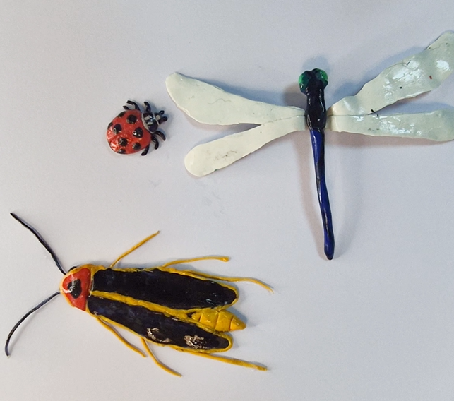
Trending News:Nature Through the Lens: Instant Lesson for Nature Photography DayFatherhood in the Animal KingdomInstant Lesson: Jazz Instrument Matching GameEnd-of-Year Favorites: The Classroom Activities Teachers Loved Most in 2026National Insect Appreciation Day: Clay Insect Sculpting CraftWorld Environment Day Crossword Puzzle13 of Our Favorite Dinosaur Exhibits in the USAClose-up with Pura Belpré: How one Brave Librarian Transformed Puerto Rican Culture in AmericaGarden Workshop: Seeds, Soil & SustainabilityDiscover the Secret Bee! Honeycomb Hex Pattern for KindergartenSports Gear Shopping Challenge | Budget Math Game for K–5Unleash the Power of Latino Literature Book RecommenderAfrica Day: Match African Nations & Their CapitalsGalápagos Giant Tortoises: From Extinction to Recovery | K-5 Life Science LessonEffortless Lesson Planning: How Teachers Save Time, and Get Engagement with This DashboardSurprising Summer Fractions Fun: Hands-On Lemonade Stand Division Activity for Early LearnersSpring Baby Animals Revealed | Interactive Smartboard-Ready Instant Lesson!Close-up with Naomi Osaka: Tennis Champion, Activist, and a Story of Two CulturesField Day Word SearchClose-up with David Attenborough: Nature’s Greatest Storyteller Turns 100Explosive, Eye-Opening and Standards-Aligned: Our Volcano Lava Flow Simulator is Here!What it would have been like to experience the dinosaur‑killing asteroid armageddon?The Perfect Poetry Month TEJ Reader to Welcome Spring!Book Review: “Listening to the Quiet”Teacher Appreciation Word SearchTeacher’s Guide to Cinco de MayoSort Out the Spring Babies! Life Science K-5th!Geometry on the Tanagram Farm Challenge (K-3)Teacher Appreciation Gratitude CardsInstant Lesson: Lei Pattern GamesLei Day Pattern BuilderLei Day Unit CounterBook Review: “A Love Letter to My Library”ASL Matching GameField Day Running Race Math Game K-5!Woven Bookmark & Rug CraftA Close-Up of Sundus Saad: Weaving Color, Texture, and MemoryStorm Simulator: Instant LessonStorm Simulator: Interactive Hurricane ScienceHonoring Spanish Language Day with “The Interpreter”Empanada Math Fiesta: Instant LessonEmpanada Math FiestaEarth Day Coloring & Memory MatchLearn About the Thai New Year Songkran: Educator’s GuideHonoring Disability Book Week: “Extraordinary Jordyn and her Bionic Ears”Color the Magic: A Unicorn Coloring PackBreaking News: Orion Re-entry and SplashdownWormly: Moon Exploration Edition — SoR SpellingMeet Wormly at the Children’s Book Fair in Bologna Italy!An Instant Guide to the Artemis II Moon PhotosNASA Live Stream for Your Classroom (Official)Breaking News: Moon Flyby Physics ExplainedLatest News from the Mission to the Moon!Background about the Artemis II from the ConversationPhysics Friday – Rocket to the Moon Mission SimulatorIn the Spring Day and Night are Equal: Lesson Plan & InteractiveEaster Egg Word Problems: Practice AdditionTeacher’s Guide to Good Friday & Easter: Traditions Around the WorldA Teacher’s Guide to Passover: History, Seder, & Jewish DiversityEloise Greenfield: Poet, Author & Educator | This Month™ Close-UpSneak Peek: Our New Storm SimulatorMake a Greek Salad With Yummy VeggiesEducators’ Guide to Cherry Blossom FestivalsInstant Lesson: March Madness for MathTeacher’s Guide to Nowruz: Persian New YearClose Up with Rita Levi-Montalcini: A Scientist Who Refused Every BoundaryQuoits: Ancient Greece Ring-TossFrench Language Day Matching GameYour Amazing Brain Series: SensesNutritious Food Coloring PackAll Buzzer Beater Math GamesBuzzer Beater Division! Mad Halves and More!Buzzer Beater Multiplication: Play Now!Madness for Math: Buzzer Beater DifferencesNutritious Food Sorting Game!Meet Bonnie St. John: Paralympic Medalist, Rhodes Scholar, and TrailblazerBeat the Buzzer Addition! Practice Here!Top 5 Crafts to Celebrate National Craft MonthCupcake Math: What Happens When Yummy Treats are Shared?Instant Guide: St. Patrick’s Pattern GamesSilenced Voices, Hard-Won Votes: An Instant Guide to Women’s SuffrageWord Search: The Dentist’s DictionaryAudio Book Review: “Crown: An Ode to the Fresh Cut”Polka Dots Everywhere! Discover the Amazing Work and Life of Yayoi KusamaSt. Patrick’s Pattern BuilderLeprechaun Pattern DetectiveSt. Patrick’s Unit CounterShamrock Pattern CompletionMeet the Saints of MarchLucky Sum St Pat’s Addition PracticeAn Educator’s Guide to the Hindu Festival HoliA Teacher’s Guide to Rare Disease DayFollow the Humpback Whales Around the World!Teacher’s Guide to the ParalympicsInstant Guide to Black Innovators Time MachineTime Machine: Meet Black InnovatorsFind Your Perfect Coretta Scott King Award Winner!Close Up of Vonetta Flowers: A Champion Who Made Winter Olympic HistoryBook Review: “Bottle Cap Boys”Black Children’s Book Week | Book Reviews
Trending News:Nature Through the Lens: Instant Lesson for Nature Photography DayFatherhood in the Animal KingdomInstant Lesson: Jazz Instrument Matching GameEnd-of-Year Favorites: The Classroom Activities Teachers Loved Most in 2026National Insect Appreciation Day: Clay Insect Sculpting CraftWorld Environment Day Crossword Puzzle13 of Our Favorite Dinosaur Exhibits in the USAClose-up with Pura Belpré: How one Brave Librarian Transformed Puerto Rican Culture in AmericaGarden Workshop: Seeds, Soil & SustainabilityDiscover the Secret Bee! Honeycomb Hex Pattern for KindergartenSports Gear Shopping Challenge | Budget Math Game for K–5Unleash the Power of Latino Literature Book RecommenderAfrica Day: Match African Nations & Their CapitalsGalápagos Giant Tortoises: From Extinction to Recovery | K-5 Life Science LessonEffortless Lesson Planning: How Teachers Save Time, and Get Engagement with This DashboardSurprising Summer Fractions Fun: Hands-On Lemonade Stand Division Activity for Early LearnersSpring Baby Animals Revealed | Interactive Smartboard-Ready Instant Lesson!Close-up with Naomi Osaka: Tennis Champion, Activist, and a Story of Two CulturesField Day Word SearchClose-up with David Attenborough: Nature’s Greatest Storyteller Turns 100Explosive, Eye-Opening and Standards-Aligned: Our Volcano Lava Flow Simulator is Here!What it would have been like to experience the dinosaur‑killing asteroid armageddon?The Perfect Poetry Month TEJ Reader to Welcome Spring!Book Review: “Listening to the Quiet”Teacher Appreciation Word SearchTeacher’s Guide to Cinco de MayoSort Out the Spring Babies! Life Science K-5th!Geometry on the Tanagram Farm Challenge (K-3)Teacher Appreciation Gratitude CardsInstant Lesson: Lei Pattern GamesLei Day Pattern BuilderLei Day Unit CounterBook Review: “A Love Letter to My Library”ASL Matching GameField Day Running Race Math Game K-5!Woven Bookmark & Rug CraftA Close-Up of Sundus Saad: Weaving Color, Texture, and MemoryStorm Simulator: Instant LessonStorm Simulator: Interactive Hurricane ScienceHonoring Spanish Language Day with “The Interpreter”Empanada Math Fiesta: Instant LessonEmpanada Math FiestaEarth Day Coloring & Memory MatchLearn About the Thai New Year Songkran: Educator’s GuideHonoring Disability Book Week: “Extraordinary Jordyn and her Bionic Ears”Color the Magic: A Unicorn Coloring PackBreaking News: Orion Re-entry and SplashdownWormly: Moon Exploration Edition — SoR SpellingMeet Wormly at the Children’s Book Fair in Bologna Italy!An Instant Guide to the Artemis II Moon PhotosNASA Live Stream for Your Classroom (Official)Breaking News: Moon Flyby Physics ExplainedLatest News from the Mission to the Moon!Background about the Artemis II from the ConversationPhysics Friday – Rocket to the Moon Mission SimulatorIn the Spring Day and Night are Equal: Lesson Plan & InteractiveEaster Egg Word Problems: Practice AdditionTeacher’s Guide to Good Friday & Easter: Traditions Around the WorldA Teacher’s Guide to Passover: History, Seder, & Jewish DiversityEloise Greenfield: Poet, Author & Educator | This Month™ Close-UpSneak Peek: Our New Storm SimulatorMake a Greek Salad With Yummy VeggiesEducators’ Guide to Cherry Blossom FestivalsInstant Lesson: March Madness for MathTeacher’s Guide to Nowruz: Persian New YearClose Up with Rita Levi-Montalcini: A Scientist Who Refused Every BoundaryQuoits: Ancient Greece Ring-TossFrench Language Day Matching GameYour Amazing Brain Series: SensesNutritious Food Coloring PackAll Buzzer Beater Math GamesBuzzer Beater Division! Mad Halves and More!Buzzer Beater Multiplication: Play Now!Madness for Math: Buzzer Beater DifferencesNutritious Food Sorting Game!Meet Bonnie St. John: Paralympic Medalist, Rhodes Scholar, and TrailblazerBeat the Buzzer Addition! Practice Here!Top 5 Crafts to Celebrate National Craft MonthCupcake Math: What Happens When Yummy Treats are Shared?Instant Guide: St. Patrick’s Pattern GamesSilenced Voices, Hard-Won Votes: An Instant Guide to Women’s SuffrageWord Search: The Dentist’s DictionaryAudio Book Review: “Crown: An Ode to the Fresh Cut”Polka Dots Everywhere! Discover the Amazing Work and Life of Yayoi KusamaSt. Patrick’s Pattern BuilderLeprechaun Pattern DetectiveSt. Patrick’s Unit CounterShamrock Pattern CompletionMeet the Saints of MarchLucky Sum St Pat’s Addition PracticeAn Educator’s Guide to the Hindu Festival HoliA Teacher’s Guide to Rare Disease DayFollow the Humpback Whales Around the World!Teacher’s Guide to the ParalympicsInstant Guide to Black Innovators Time MachineTime Machine: Meet Black InnovatorsFind Your Perfect Coretta Scott King Award Winner!Close Up of Vonetta Flowers: A Champion Who Made Winter Olympic HistoryBook Review: “Bottle Cap Boys”Black Children’s Book Week | Book Reviews
Image: “The Great Wave off Kanagawa” (1830-1832) | Artist: Katsushika Hokusai (1760-1849) | Collection: Metropolitan Museum of Art (JP1847) | Public Domain
Although this famous artwork is often used in tsunami literature, Hokusai’s waves are actually okinami (沖波) also known as great offshore waves caused by wind and weather, not tsunami (津波). Real tsunamis look very different because they are barely noticeable in deep ocean but transform into powerful walls of water near the shore due to the shoaling effect. This guide explores the real science of tsunamis, as well as safety. Children as young as four years are old enough to learn about the warning signs of tsunamis. One major warning sign is the ocean’s sudden retreat, and young children can warn their families urgently to get to higher ground. This guide is meant for families and all educators, because a working knowledge of tsunami science and safety can save lives. While this content has been optimized for tablets and smartboards, you can still view it on a mobile device, we recommend rotating your phone.
-Dr. K. M. Schlatter
Like this…
🌊 Instant Guide to Tsunami Science & Safety
Understanding wave physics, warning systems, and coastal preparedness • In recognition of Tsunami Awareness Day
📚 FOR EDUCATORS: Learning Objectives & Standards▼
Grades K-1 (45-60 minutes)
Understand that tsunamis are different from regular ocean waves
A tsunami is a very special kind of ocean wave that starts underwater. Unlike regular waves made by wind, tsunamis are made by earthquakes, volcanoes, or landslides under the ocean!
High-definition animation showing seismic activity generating a tsunami and its propagation to shore
Video: Tsunami Generation Animation Credit: National Oceanic and Atmospheric Administration (NOAA) Format: MP4 1280×720 License: Public Domain Download:http://go.usa.gov/SRNw
Deep under the ocean, the ground can shake during an earthquake. When the ocean floor moves up or down really fast, it pushes ALL the water above it up too – like lifting a giant bathtub!
This creates a tsunami wave that spreads out in all directions, like ripples when you drop a rock in a pond – but MUCH bigger!
In the deep ocean, tsunami waves are very small – only about as tall as a grown-up! But as they get closer to the beach, they grow MUCH bigger. That’s why tsunamis can be so dangerous near the shore.
Remember: Regular waves happen all the time and are safe to play in at the beach. Tsunamis are rare and very different!
Tsunamis are ocean waves caused by sudden movements of the seafloor, usually from underwater earthquakes. Unlike wind-driven waves that only affect the surface, tsunami waves involve the entire water column from seafloor to surface!
High-definition animation showing seismic activity generating a tsunami and its propagation to shore
Video: Tsunami Generation Animation Credit: National Oceanic and Atmospheric Administration (NOAA) Format: MP4 1280×720 License: Public Domain Download:http://go.usa.gov/SRNw
Key Differences from Regular Waves:
Regular waves: Caused by wind, affect only surface, wavelength ~100-300 feet
Tsunami waves: Caused by seafloor movement, affect entire water depth, wavelength can be 100+ miles!
Because tsunami wavelengths are so long, these waves can travel across entire ocean basins at speeds of 500+ mph in deep water!
Most tsunamis are caused by underwater earthquakes. When tectonic plates (giant pieces of Earth’s crust) suddenly shift, the seafloor can move up or down by several feet in just seconds.
This rapid displacement pushes the entire water column upward, creating a bulge at the ocean surface. Gravity then pulls this bulge back down, but the energy spreads outward as tsunami waves traveling in all directions.
Other causes of tsunamis:
Underwater volcanic eruptions
Submarine landslides
Rarely: meteorite impacts in the ocean
Tsunamis are gravity waves generated by impulsive vertical displacement of the water column. The most common cause is submarine earthquakes along subduction zones, where tectonic plates collide and one plate slides beneath another.
High-definition animation showing seismic activity generating a tsunami and its propagation to shore
Video: Tsunami Generation Animation Credit: National Oceanic and Atmospheric Administration (NOAA) Format: MP4 1280×720 License: Public Domain Download:http://go.usa.gov/SRNw
Scientific Classification:
Wave type: Shallow-water gravity wave (wavelength >> water depth)
Wavelength: 10-500 km (6-310 miles)
Period: 10 minutes to 2 hours between wave crests
Speed formula: v = √(g × d), where g = gravity and d = depth
This speed relationship explains why tsunamis travel at 500-800 km/h (300-500 mph) in deep ocean (depth ~4000m) but slow to 30-50 km/h (20-30 mph) near shore (depth ~10m).
Tsunami generation requires impulsive vertical displacement of a large volume of water. The most common mechanism occurs at subduction zones where converging tectonic plates create megathrust earthquakes.
Generation Process:
Strain accumulation: The overriding plate compresses as the subducting plate pulls it downward
Rupture: Sudden release of accumulated strain causes the overriding plate to snap upward (vertical displacement typically 1-15 meters)
Water column displacement: The entire water column above the displaced seafloor rises instantaneously
Wave propagation: Gravitational potential energy converts to kinetic energy, creating waves that propagate radially from the source
Energy scale: A magnitude 9.0 earthquake can displace hundreds of cubic kilometers of water, releasing energy equivalent to thousands of atomic bombs – though most of this energy remains in the water, not dissipating until the waves reach shallow water.
Animation: NOAA Tsunami Generation and Propagation Credit: National Oceanic and Atmospheric Administration (NOAA) Description: Animation showing seismic activity generating a tsunami, wave propagation across the ocean, and coastal inundation License: Public Domain Download:http://go.usa.gov/SRNw
Animation: NOAA Tsunami Generation and Propagation Credit: National Oceanic and Atmospheric Administration (NOAA) Description: Animation showing seismic activity generating a tsunami, wave propagation across the ocean, and coastal inundation License: Public Domain Download:http://go.usa.gov/SRNw
🎮 Interactive Tsunami Simulator
Explore how earthquake magnitude, ocean depth, and coastal slope affect tsunami behavior. Watch the wave grow as it approaches shore!
What you’ll see: The wave starts small in the deep blue ocean, then grows bigger and bigger as it gets closer to the beach. This is exactly what real tsunamis do!
Try the preset scenarios:
Small Tsunami: Gentle slope spreads energy out (8-15 ft waves)
Moderate Tsunami: Typical coastal conditions (20-30 ft waves)
Major Tsunami: Steep slope concentrates energy (50-70+ ft waves)
Notice how the wave slows down dramatically as it enters shallow water!
Physics principles demonstrated:
Wave speed: v = √(g × d) where g = 9.8 m/s² and d = depth
Shoaling amplification: Height ratio ≈ (depth ratio)^0.25
Energy conservation: As speed decreases, energy converts to amplitude
Coastal slope effects: Steep slopes (cliffs, fjords) concentrate energy vertically; gentle slopes (beaches) allow energy to dissipate over distance
🗺️ Tsunami Travel Across Ocean Basins
When a tsunami starts in one part of the ocean, it travels outward in big circles – like when you splash in a bathtub and ripples go everywhere!
These waves can cross an entire ocean. A tsunami starting near Japan can reach Hawaii, or one starting near Indonesia can reach Africa! It takes many hours for the waves to travel that far.
Tsunami waves spread out from their source in concentric circles, similar to ripples in a pond but on an enormous scale. Because they travel so fast in deep water (500+ mph), they can cross entire ocean basins in less than a day.
Travel times from the 2004 Indian Ocean Tsunami:
Indonesia (epicenter): 15-30 minutes
Thailand: 1-2 hours
Sri Lanka & India: 2-3 hours
East Africa: 7-8 hours
This is why tsunami warning systems are so important – distant coasts have hours to prepare and evacuate!
Tsunami propagation follows predictable patterns based on bathymetry (seafloor topography) and the shallow-water wave equation. Wave energy is guided by underwater features like mid-ocean ridges and channels, causing focusing or defocusing effects.
Propagation characteristics:
Deep ocean: Minimal energy loss; waves can travel 10,000+ km
Wave refraction: Bathymetric features bend wave fronts, concentrating energy in some areas
Edge waves: Waves can be trapped along continental margins, traveling along coastlines
Modeling: Modern tsunami models use finite-element methods to solve the nonlinear shallow-water equations across high-resolution bathymetric grids, enabling accurate prediction of arrival times (within minutes) and wave heights (within 50%).
Travel time map for 2004 Indian Ocean tsunami – colors show how many hours it took waves to reach different locations
Image: Tsunami Travel Time Map – 2004 Indian Ocean Tsunami Source: National Oceanic and Atmospheric Administration (NOAA) Date: December 26, 2004 Color Legend: Red/White = 0-1 hour, Orange = 1-3 hours, Yellow = 3-6 hours, Green = 6-10+ hours License: Public Domain
Animation showing wave propagation from the 1975 Hawaii earthquake – demonstrates local tsunami behavior around islands
Video: 1975 Kalapana Tsunami Animation – Hawaii Event Date: November 29, 1975 Earthquake: 7.7 magnitude, southeast coast of Big Island Maximum Wave: 48 ft (14.6 m) Source: USGS (United States Geological Survey) / Pacific Tsunami Warning Center License: Public Domain
⚠️ Natural Warning Signs & Safety Preparedness
🚨 Critical Safety Information
If you feel strong shaking near the coast, or shaking that lasts more than a minute, do NOT wait for an official warning. Evacuate immediately to high ground (at least 50 feet / 15 meters above sea level) or move inland.
For local tsunamis, the earthquake IS the warning. You may have only minutes to reach safety.
Two important warning signs:
Strong shaking: If the ground shakes really hard near the ocean, RUN to high ground right away!
Ocean goes out: If you see the ocean pull way back and expose the beach, don’t go look – RUN UP! A big wave is coming!
Remember: Don’t wait for grown-ups to tell you what to do. If you feel strong shaking or see the ocean disappear, RUN to high ground immediately!
What to do if you’re near the ocean:
Learn where the high ground is near your home or school
Practice going there with your family
If you feel strong shaking, go to high ground right away
Stay there until grown-ups say it’s safe to come back
Don’t go to the beach to look at the waves – they’re dangerous!
Three critical natural warning signs:
Strong earthquake shaking: If you feel an earthquake so strong you can’t stand up, OR shaking that lasts more than a minute while near the coast, evacuate immediately. Don’t wait for sirens!
Ocean drawback: The ocean suddenly pulls way back, exposing the seafloor, fish, and shells. This happens because the trough (low part) of the tsunami wave arrives first. The crest (high part) follows within minutes.
Loud roaring sound: Some survivors describe hearing a sound like a freight train or jet engine approaching from the ocean.
Why drawback is dangerous: People are naturally curious and may walk out to explore the exposed seafloor. This is extremely dangerous – you have only minutes before the wave arrives, and you’ll be caught in the open with nowhere to run!
Family preparedness checklist:
Know your tsunami evacuation zone (check local maps or ask local emergency management)
Identify multiple evacuation routes to high ground
Practice evacuation with your family
Have a family communication plan (meeting point, out-of-area contact)
If visiting a coastal area, ask about evacuation routes and zones
During evacuation:
Move quickly but carefully – don’t drive if roads are crowded
Help neighbors who may need assistance (elderly, disabled)
Bring pets if safe to do so
Once in a safe area, stay there – don’t return until officials say it’s safe
Natural warning indicators and their mechanisms:
Seismic precursor: Earthquake magnitude >7.0 within 100 km of coast indicates high tsunami risk. Ground shaking provides 2-30 minutes warning depending on distance from source. Modified Mercalli Intensity ≥VII indicates potential tsunami threat.
Drawback phenomenon: Occurs when the leading depression (trough) of the tsunami wave arrives first. Wavelengths of 10-100+ km mean drawback can occur 5-45 minutes before the first major crest. Water recession of 500+ meters suggests wave amplitude >5 meters.
Acoustic signals: Tsunami waves approaching shore compress air and create infrasound (<20 Hz, below human hearing) and audible frequencies. Described as continuous roar or rumble, caused by wave interaction with seafloor topography.
Animal behavior: Some animals may detect seismic P-waves or infrasound before humans. While anecdotal, unusual animal behavior (dogs barking, birds fleeing) should not be dismissed near coasts post-earthquake.
Critical timing: For near-field tsunamis (within 100 km of source), arrival times can be 10-30 minutes. Human evacuation requires 15-20 minutes minimum. Therefore, natural warnings must trigger immediate action without waiting for official alerts.
Evidence-based preparedness strategies:
Vertical evacuation: Purpose-built tsunami evacuation structures in areas where reaching high ground is impossible. Must withstand debris impact and provide refuge above maximum predicted inundation.
Land-use planning: Tsunami hazard zones inform building codes, critical infrastructure siting, and development restrictions. Inundation models identify areas at risk.
Community education: Regular drills, signage, and public education programs. Studies show areas with frequent drills have significantly higher survival rates.
Warning dissemination: Multiple channels (sirens, cell broadcast, social media) increase reach. Last-mile dissemination remains challenging in remote areas.
Building design: Elevated structures on breakaway walls, reinforced construction, strategic building orientation to deflect flow.
Post-2004 improvements: The 2004 Indian Ocean tsunami killed 230,000+ people. Subsequent investments in Indian Ocean Tsunami Warning System, community preparedness, and building standards have significantly reduced vulnerability. The 2011 Japan tsunami, despite larger waves, resulted in fewer deaths due to superior preparedness.
📡 Tsunami Warning Systems
Scientists around the world watch the ocean all the time using special underwater sensors. When a big earthquake happens under the ocean, these sensors can tell if a tsunami is coming!
If a tsunami is heading toward land, the scientists send warnings to people who live near the beach. Sirens go off to tell everyone to move to high ground where they’ll be safe.
Remember: If you hear a tsunami siren, listen to grown-ups and go to high ground right away!
Modern tsunami warning systems use a network of technologies to detect tsunamis and alert coastal communities:
How warning systems work:
Seismometers: Detect earthquakes within minutes and calculate magnitude and location
Ocean buoys: DART (Deep-ocean Assessment and Reporting of Tsunamis) buoys measure tiny changes in sea level, confirming if a tsunami has formed
Computer models: Predict where waves will travel and when they’ll arrive
Alert systems: Send warnings via sirens, text messages, radio, and TV
Two types of warnings:
Distant tsunami: Hours of warning time (like from across the Pacific Ocean)
Local tsunami: Minutes of warning time – natural signs are your warning!
Tsunami Early Warning Systems (TEWS) integrate seismic monitoring, real-time ocean observations, numerical modeling, and dissemination infrastructure.
System components and capabilities:
Seismic networks: Global Seismographic Network (GSN) provides magnitude and location within 5-15 minutes. Moment tensor solutions determine focal mechanism (thrust, strike-slip, normal) to assess tsunamigenic potential.
DART buoys: Bottom Pressure Recorders (BPR) detect sea level changes of <1 cm. Acoustic transmission to surface buoy, then satellite uplink to Warning Centers. 15-minute reporting intervals in event mode.
Tide gauges: Coastal stations provide near-shore validation but arrive too late for near-field warnings. Useful for monitoring wave trains (multiple waves over hours).
Numerical models: MOST (Method of Splitting Tsunami), COMCOT, and similar codes solve shallow-water equations on nested grids. Pre-computed scenario databases enable rapid forecasts.
Decision support: Warning Centers (PTWC, JMA, BMKG, others) use decision matrices combining seismic parameters, ocean observations, and model outputs. Time to decision: 5-30 minutes.
Limitations: Near-field tsunamis (<100 km) arrive faster than warning dissemination. No technology can replace self-evacuation based on natural warnings for local events.
📚 Media Sources & Citations
This guide uses public domain materials from NOAA and USGS. All content is used in compliance with U.S. government media usage guidelines for educational purposes.
World Tsunami Awareness Day 2025
Theme: Be Tsunami Ready: Invest in Tsunami Preparedness Date: 05 November 2025 Website:https://tsunamiday.undrr.org/ Organization: United Nations Office for Disaster Risk Reduction (UNDRR)
Hokusai Artwork
Title: “The Great Wave off Kanagawa” (神奈川沖浪裏) Artist: Katsushika Hokusai (1760-1849) Date: circa 1830-1832 Collection: Metropolitan Museum of Art (Accession: JP1847) License: Public Domain
NOAA Tsunami Generation Animations
Credit: National Oceanic and Atmospheric Administration (NOAA) Format: MP4 and GIF animations Download:http://go.usa.gov/SRNw License: Public Domain
Travel Time Map & 3D Visualizations
Source: NOAA Center for Tsunami Research (NCTR) License: Public Domain
1975 Hawaii Tsunami Animation
Source: USGS / Pacific Tsunami Warning Center Event: November 29, 1975 Kalapana Earthquake (M7.7) License: Public Domain
Interactive Tsunami Simulator
Created by: This Month™ with Claude AI License: Original educational content
U.S. Government Media: NOAA and USGS content is generally not subject to copyright in the United States and may be used for educational purposes with proper attribution. This Month™ does not claim endorsement by NOAA or USGS.
🌊 This Month™ Educational Resources
Timely, standards-aligned educational activities for K-5th grade classrooms and families.
Connecting learning to the calendar through month-specific, culturally relevant, and seasonally appropriate experiences.
In recognition of World Tsunami Awareness Day (November 5)
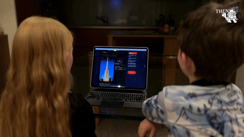
Nature Through the Lens: Instant Lesson for Nature Photography Day
This Month™ Instant Lesson: Nature Through the Lens is a K–5 smartboard lesson for Nature Photography Day (June 15) built around four real photographs. Each photo anchors a core science…
This Father’s Day, pair quality time with purposeful learning by watching “Fatherhood in the Animal Kingdom”, a 2024 BBC Earth short documentary that follows wildlife fathers — from seahorses to…